Map design for a bike navigation app
Cooperation study project
beemo GmbH, Münster
Münster School of Design
Semester project
Winter semester 17/18
beemo GmbH, Münster
Münster School of Design
Semester project
Winter semester 17/18
My Part
Color theme, Map design day/night,
Prototype testing, Realization
Color theme, Map design day/night,
Prototype testing, Realization
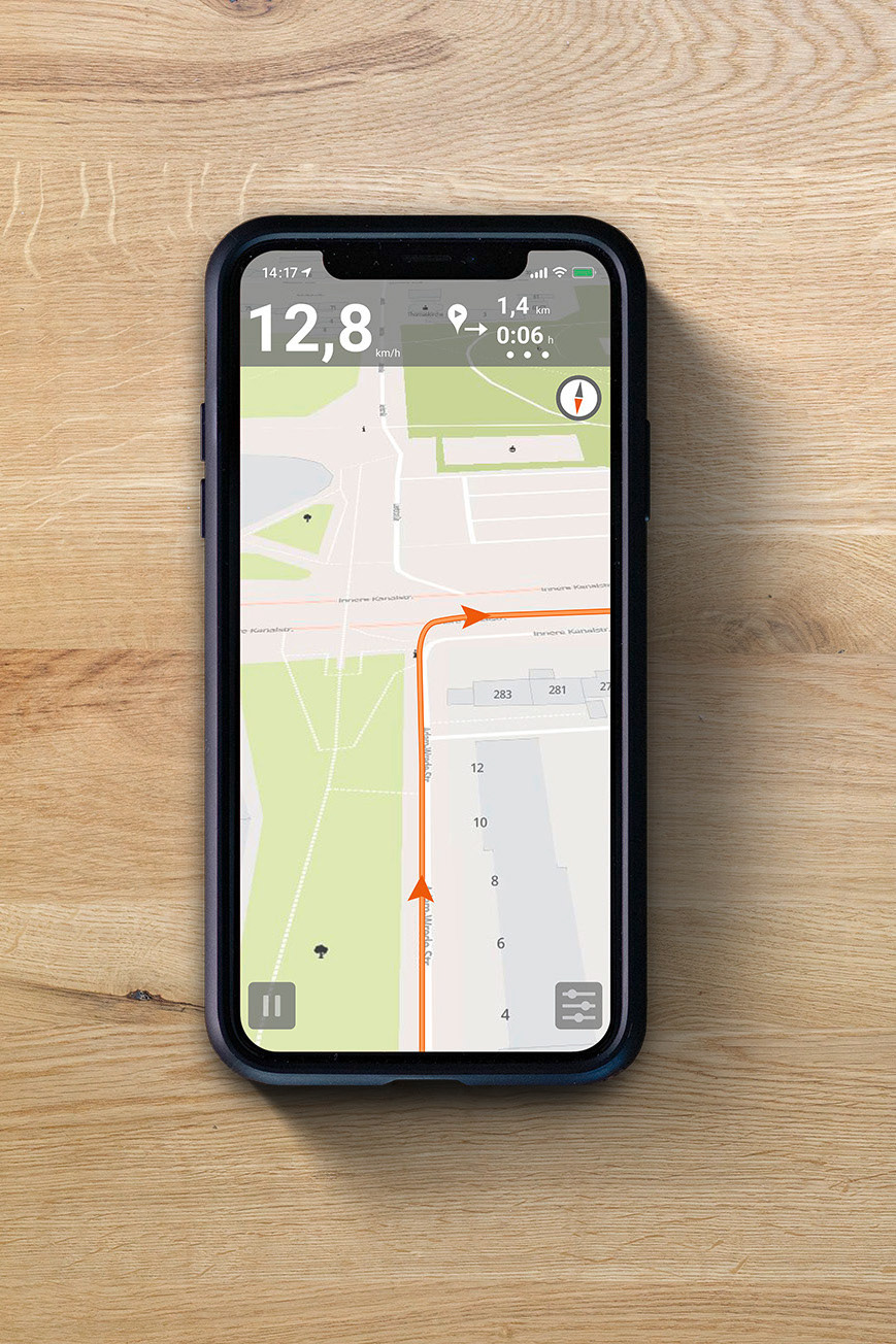
The navigation app Naviki was created as a result of a project at the Münster University of Applied Sciences and it is now a popular navigation system that is used worldwide to plan bicycle routes. A corporate design has already been developed for the application, but it was limited to the app and web interface, not to the map itself. Therefore, I developed a map style that is integrated into the Navikiworld.
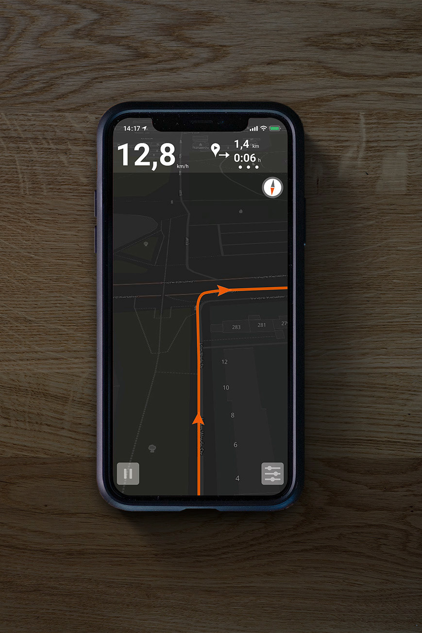
With a total of 18 zoom levels, the digital map offers many options for displaying and hiding information. There was also the development of a night map and the observance of the official cycle routes. In this way a day and night map was created that can optionally display specific cycle routes. The day map was adopted by Naviki and embedded in the system.
With a total of 18 zoom levels, the digital map offers many options for displaying and hiding information. There was also the development of a night map and the observance of the official cycle routes. In this way a day and night map was created that can optionally display specific cycle routes. The day map was adopted by Naviki and embedded in the system.
